Central Valley, California: Aquifer Management
A project in the Central Valley of California involved creating a groundwater-surface water management master plan. The groundwater-surface water model was used to develop conjunctive use alternatives. This project demonstrates the river simulation and agricultural land use capabilities of DYNSYSTEM.
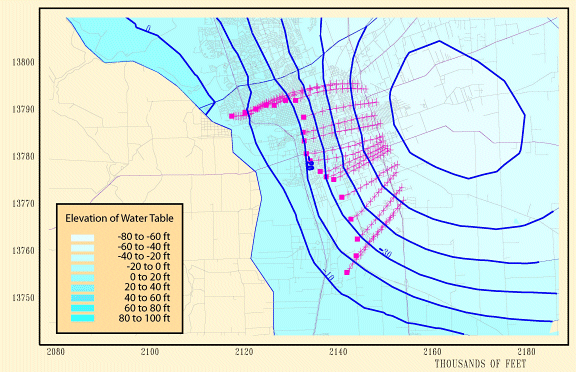
The picture below displays the intrusion of saline water due to overdraft in the urban center. Particle tracking done in DYNTRACK provides a quick and simple means to estimate changes to the rate of intrusion with different management options.
DYNPLOT was also used in this project to display
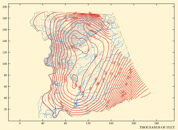
Regional Groundwater Table
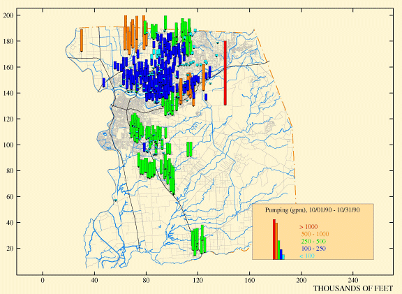
Spatial Distribution of Groundwater Pumping
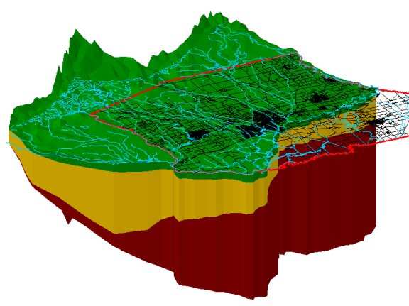
DYNPLOT can also be used to plot materials in aerial and cross-section views as shown in these pictures.
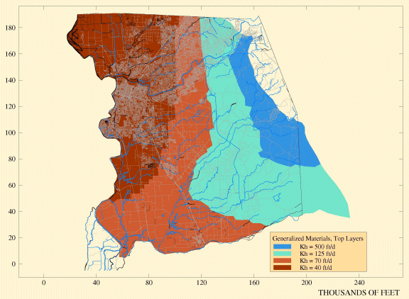
DYNPLOT Material Plot
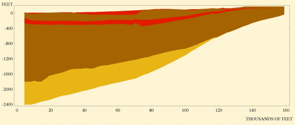
DYNPLOT Material Plot in Cross-Section