Gaza Coastal Aquifer, Palestine: Coastal aquifer management planning
The Gaza coastal aquifer in Palestine is threatened by saltwater intrusion. This project brought together the themes of coastal aquifer management, seawater intrusion modeling adn density dependent flow modeling. A coupled-flow and transport model was used to investigate the extent of saltwater intrusion in both historic and predictive simulations. The model was very successful in defining the nature and scale of saltwater intrusion and will be an integral tool for future aquifer management.
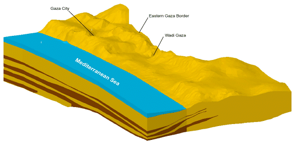
3D Eastern Aquifer Model Viewed in GMS
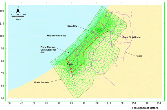
The following image shows the finite-element grid for the Eastern Aquifer model. One can certainly see the benefit of a finite-element system in the localized grid density on-site.
The next two pictures demonstrate the effect of municipal pumping on the Eastern Aquifer system as simulated using DYNCFT. The first picture is a "predevelopment" snapshot circa 1935. The second picture shows the aquifer's current condition.
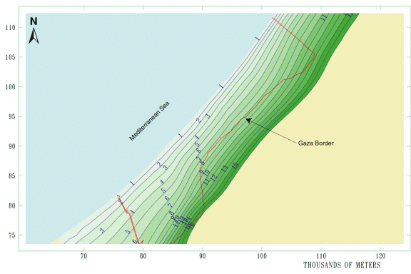
Simulated Heads Circa 1935
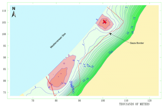
Simulated Heads Circa 1999
This picture compares simulated salinity concentrations to resistivity data and shows that the model has very good agreement with the data.
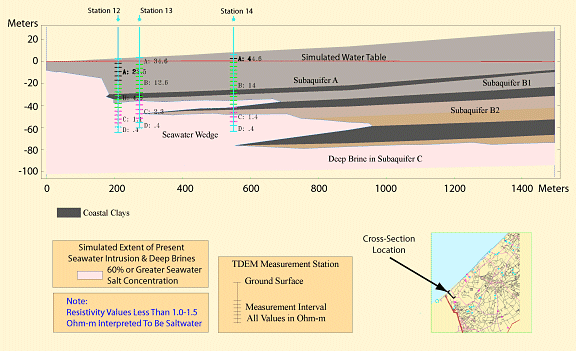
Simulated vs. Observed Salinity Concentrations
This picture compares simulated seawater wedge migration to chloride levels in municipal wells and illustrates why some of the wells have had to been relocated to parts of the aquifer that aren't experiencing seawater intrusion.
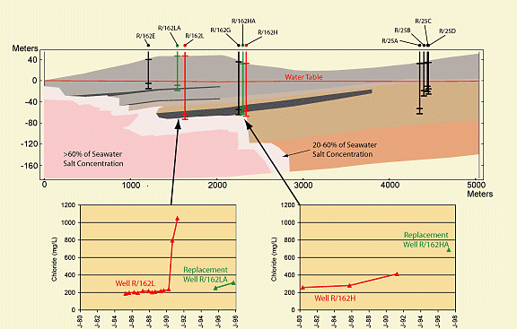
Well Replacement Due to Salt Contamination