West Bank, Palestine: Regional groundwater management planning
A project in the Eastern Aquifer of Palestine included an integrated aquifer management plan. The DYNSYSTEM model was used to simulate a complex, multi-layer aquifer system. The model was large, measuring approximately 3,000 square kilometers in area and 1,300 meters thick. The model was also used to site new production wells.
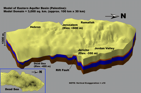
3D West Bank Model viewed in GMS
The following image of the DYNFLOW flowfield displays how a modeler can assert structural control on the groundwater model using DYNSYSTEM.The results show that an anticline and syncline inserted into the model faithfully redirect groundwater movement. Although it cannot be seen in the picture, the model also reproduces discharge at springs on the banks of the Dead Sea. The volumetric flows at these springs can easily be found by querying DYNFLOW.
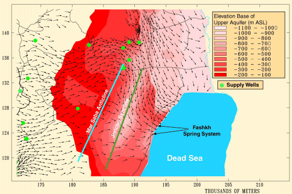
Structural Control on Groundwater Flow